

Fall Colors in Western North Carolina
Fall Color in Western North Carolina: A Week by Week Timing Guide from the Old Fort Valley
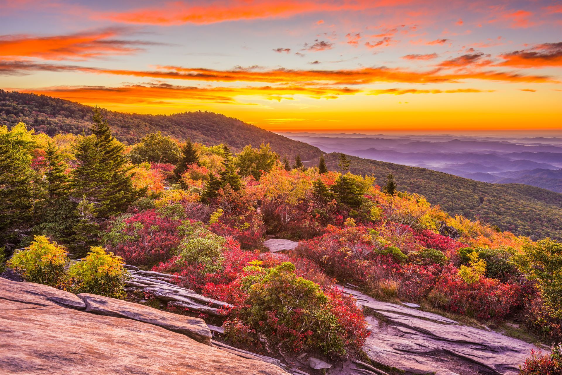
Fall color in Western North Carolina moves downhill. The highest peaks above 6,000 feet turn in late September. Asheville and the mid-elevation peaks reach their peak in the third and fourth weeks of October. The valley floor around Old Fort, at roughly 1,400 feet, holds its color into early November. Pick your elevation, and you pick your week.
Why does elevation decide the date, not the calendar?
Most people plan a leaf trip around a weekend. The mountains do not work that way.
The rule that governs everything below comes from Dr. Howard Neufeld and Michael Denslow at Appalachian State University, who built the North Carolina fall color map around a single relationship. For every 1,000 feet of elevation gain, peak color arrives about one week earlier.
That single sentence is the most useful piece of trip planning information in these mountains. The vertical distance between the summit of Mount Mitchell and the valley floor at Old Fort is more than 5,000 feet. Five thousand feet is five weeks. The same drive, taken on the same Saturday, can show you bare branches at the top and deep green at the bottom.
It also means something practical for anyone booking a stay. A valley base at 1,400 feet does not put you at the end of the season. It puts you at the bottom of a five week escalator. You drive up to find the color, and you come back down to a valley that has not turned yet.
Dr. Neufeld publishes a live weekly report each autumn at fallcolorguy.org. It is the best source for what is actually happening in a given week, and it is worth checking the Thursday before you travel.
When does fall color peak by elevation?
Treat these as windows rather than appointments. Weather over the six weeks beforehand shifts the peak by roughly a week in either direction. A dry late summer tends to pull color slightly earlier and mute the reds. A warm, wet September pushes everything later.
Above 6,000 feet
Mount Mitchell, Mount Craig, the Black Mountain crest.
Peak arrives in late September and the first days of October. You will see yellow birch, mountain ash heavy with berries, and spruce and fir staying stubbornly green underneath everything else. This is the earliest color in the eastern United States, and most people miss it entirely because it happens while the valleys are still fully green and nobody is thinking about leaves yet.
5,000 to 6,000 feet
Craggy Gardens, Craggy Pinnacle, the high Parkway overlooks.
The first and second weeks of October. Mountain ash, birch and early red maple across open, wind stripped ridgelines. This is the most photographed color in the region.
4,000 to 5,000 feet
The upper Parkway, Little Switzerland, the higher coves.
The second and third weeks of October, and this is where the deepest reds of the season live. Sugar maple, birch and beech.
3,000 to 4,000 feet
The Blue Ridge escarpment, upper Curtis Creek, the higher trail sections.
The third week of October. Maple, oak, hickory, and sourwood, which turns crimson earlier than anything around it.
2,000 to 3,000 feet
Black Mountain, Asheville, Point Lookout, the ridge above Old Fort.
The third and fourth weeks of October. Oak, hickory, poplar and dogwood. This is the band most visitors actually experience, because it is where the towns are.
1,200 to 2,000 feet
Old Fort, the Catawba River valley, Marion, Lake James.
The last week of October into the first week of November. Oak and hickory gold, late maple, and sycamore along the water. This is the band nobody plans for and the one that quietly outlasts everything above it.
What does the week-by-week progression look like?
If you are trying to time one trip, this is the version to save.
- September 20 to 30. Color is peaking only above 6,000 feet. Point the car at Mount Mitchell State Park, the summit trail and the observation deck.
- October 1 to 7. The 5,500 to 6,000 foot band. Craggy Gardens, Craggy Pinnacle, and the high overlooks north of Asheville.
- October 8 to 15. The 4,500 to 5,500 foot band. The open Parkway sections, Green Knob, and the upper coves.
- October 16 to 23. The 3,000 to 4,500 foot band. Upper Curtis Creek, the ridge trails, and Little Switzerland where access allows.
- October 24 to 31. The 2,000 to 3,000 foot band. Point Lookout Greenway, Black Mountain, the Old Fort Gateway Trails and Asheville.
- November 1 to 8. Below 2,000 feet. The Catawba River valley, Catawba Falls, Lake James, and the drive along Curtis Creek Road.
- November 9 to 15.
The late holdouts and the last of the oaks. The valley floor, plus the low water views that only open once the leaves have dropped.
That last week is the one nobody plans for and the one photographers keep coming back for. Once the canopy thins, the creeks and the ridgelines become visible in a way they simply are not in October.
Can you still drive the Blue Ridge Parkway this fall?
Partly, and the answer changes. This is the question that matters most for a 2026 leaf trip, so check it yourself before you drive.
Recovery work on the Parkway in North Carolina is ongoing. The National Park Service has said that work to reopen the stretch between Mount Mitchell and Little Switzerland is
expected to be complete by late 2026. Until that work finishes, several sections north of Mount Mitchell remain closed to through traffic.
As of the Park Service closure listing dated August 16, 2026:
Currently closed
- Milepost 317.5 to 324.7, US 221 to Jacksontown Access Road
- Milepost 324.7 to 327.5, part of the Jacksontown to Gillespie Gap stretch
- Milepost 333.9 to 342.1, Little Switzerland to Victor Crossing
- Milepost 342.1 to 344.2, Victor Crossing to NC 80
- Milepost 344.2 to 355.3, NC 80 to Mount Mitchell
- Linville Falls Campground and Picnic Area at milepost 316.5
Currently open
- Milepost 327.5 to 330.9
- Milepost 330.9 to 333.9, Gillespie Gap to Little Switzerland
- Milepost 355.3, Mount Mitchell
- Milepost 355.3 to 364.5, Mount Mitchell to south of Craggy Gardens
- Milepost 364.5 to 367.6, the Craggy Gardens area, though the picnic area is closed
Verify before you go. The Park Service maintains the current listing at
nps.gov road status and closures. Sections open and close week to week as crews finish work, and a closure map from three weeks ago is not information; it is a guess.
What that means in practice
The closure between NC 80 and Mount Mitchell is the one that changes your route. You cannot currently reach Mount Mitchell by driving up the Parkway from the Marion and Little Switzerland side.
From the Old Fort valley, the working approach to the high country is west on Interstate 40 toward Asheville, then north onto the Parkway, then out to Mount Mitchell and Craggy Gardens on the open section between mileposts 355 and 367. It is a longer loop on the map and it is currently the reliable one.
The upside is real. Two of the three best high-elevation color destinations in the state sit on open road, and the traffic that used to arrive from the north is not arriving.
Where should you go from Old Fort for fall color?
Old Fort sits at roughly 1,400 feet at the foot of the Blue Ridge escarpment, which is the wall of mountains rising to the north and west. Everything below is a day trip from the valley
.
Mount Mitchell State Park
stands at 6,684 feet, the highest point east of the Mississippi River. Peak color arrives in late September and early October, and it is about an hour and fifteen minutes away via Asheville.
Craggy Gardens and Craggy Pinnacle
sit between roughly 5,500 and 5,900 feet and peak in early October. About an hour away, again by way of Asheville. The open balds mean the color is not just around you but spread out below you.
Little Switzerland
sits near 3,500 feet and peaks in mid-October. Under an hour, though the route is subject to Parkway closures.
Point Lookout Greenway
climbs from roughly 1,500 to 2,400 feet, paved, 3.6 miles, peaking in late October. Under ten minutes from town.
The Old Fort Gateway Trails
run between roughly 1,500 and 2,500 feet and peak in late October. Under ten minutes.
Catawba Falls sits between roughly 1,500 and 2,200 feet and holds color from late October into early November. About ten minutes away. The Forest Service rebuilt this trail with a staircase and an observation tower and reopened it in 2024. Following storm damage, the upper viewing platform and the Wildflower Trail have been closed for repair, so check the
Forest Service page
before you drive out and follow posted signage on site.
Curtis Creek Road and Curtis Creek Campground in Pisgah National Forest climb from roughly 1,500 feet toward the Parkway, which means the color is layered rather than uniform through late October. This is the road the valley sits on, so the drive time is zero.
Lake James State Park sits near 1,200 feet and peaks in early November, about twenty-five minutes away. Water and color together, which is a different photograph than a ridgeline.
What is the best single day fall color drive from the valley?
Start low and climb. It is the only itinerary that works in every week of October because, in any given week, you will pass through the peak elevation.
- Morning, valley floor. Coffee in downtown Old Fort, then the paved Point Lookout Greenway for the first long view down the gorge.
- Late morning, the climb. Interstate 40 west, then north onto the Parkway above Asheville.
- Midday, the high country. Craggy Gardens for the ridgeline, then Mount Mitchell for the summit. Bring a layer. The summit runs roughly twenty degrees colder than the valley you left.
- Afternoon, the descent. Come back down through the elevation bands you drove up through. The light after three in the afternoon does more for color than anything you can do with a camera.
- Evening, the valley. Back down by dark, when the fire circle is lit, and the sauna is hot.
Frequently asked questions
When is peak fall color in Asheville?
Asheville sits at roughly 2,100 feet and typically peaks in the third and fourth weeks of October. The mountains above the city peak earlier, and the valleys below it peak later.
When is peak fall color on Mount Mitchell?
Mount Mitchell tops out at 6,684 feet and typically peaks in late September into the first days of October, which is three to five weeks ahead of the valleys below it.
Is it too late to see fall color in November in North Carolina?
No, if you go low. Elevations below 2,000 feet, including the Catawba River valley around Old Fort and Marion, commonly hold color into the first week of November. The high country will be bare by then.
Does drought change fall color?
Yes. A dry late summer tends to move the peak slightly earlier and mute the reds, since red pigment develops best with warm, sunny days and cool nights. Yellows are more reliable year-to-year. The
weekly fall color report
tracks this in real time.
Which weekend is busiest?
The middle two weekends of October, when the mid elevations peak and the Parkway carries its heaviest traffic of the year. If you can travel Tuesday through Thursday, the same overlooks are a different experience.
Do I need reservations for fall?
For lodging, yes, and earlier than you would think. October weekends in Western North Carolina book out well in advance.
Where should you stay for a fall color trip?
Stay low and drive up. A valley base gives you two things a mountaintop rental cannot. You reach every elevation band within about an hour, and your own trees are still turning when the high country has gone bare.
Wunderland Resort sits on 35 acres off Curtis Creek Road in Old Fort, at the foot of the escarpment with direct access to Pisgah National Forest. Lodging runs from forest villas to glamping pods to vehicle and tent sites, and the property includes a natural water cold plunge, a sauna, fire pits, and a grounding trail. Cell service on the property is effectively nonexistent, which most guests come to consider part of the point.
Keep reading
Sources and further reading
- North Carolina Fall Color Map, Appalachian State University Department of Biology
- Fall Color Guy weekly report, Dr. Howard Neufeld
- Blue Ridge Parkway road closures, National Park Service
- Parkway reopening work between Mount Mitchell and Little Switzerland, National Park Service
- Mount Mitchell State Park, North Carolina State Parks
- Catawba Falls Recreation Area, USDA Forest Service
- Lake James State Park, North Carolina State Parks
- G5 Trail Collective, Old Fort Gateway Trails
- Fall color forecast, RomanticAsheville